In the Heart of the Hill Country: Adventure Awaits!
Encourage your wedding guests to explore the area and discover the hidden gems of the Hill Country. They can visit local wineries, sample craft beers, browse antique shops, or simply enjoy the breathtaking scenery. To learn more on all the things there is to do in Texas Hill Country, view our page on Area Attractions or you can visit Travel Texas as well for information.
With the Texas Hill Country as your backdrop, your wedding day will be an enchanting experience that you and your guests will never forget.
Encourage your wedding guests to explore the area and discover the hidden gems of the Hill Country. They can visit local wineries, sample craft beers, browse antique shops, or simply enjoy the breathtaking scenery. To learn more on all the things there is to do in Texas Hill Country, visit our Texas Hill Country Area Attractions page or you can visit Travel Texas as well for information.
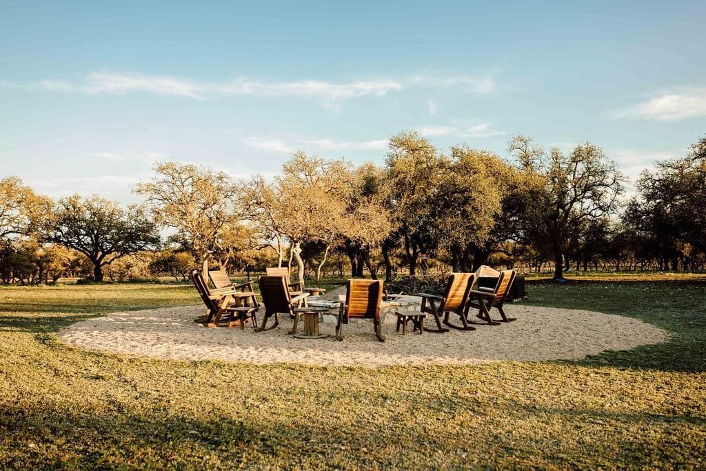
7. Fireside Festivities: Gather ‘Round the Extra-Huge Firepit
As the sun sets and the stars begin to twinkle, gather around our extra-huge firepit for an evening of fireside festivities. Roast marshmallows, share stories, and enjoy the warmth of the fire with your loved ones.
The firepit provides a cozy and inviting atmosphere for late-night conversations and unforgettable memories. It’s the perfect way to end your wedding day on a high note.
4. Privacy and Seclusion: Your Own Private Paradise
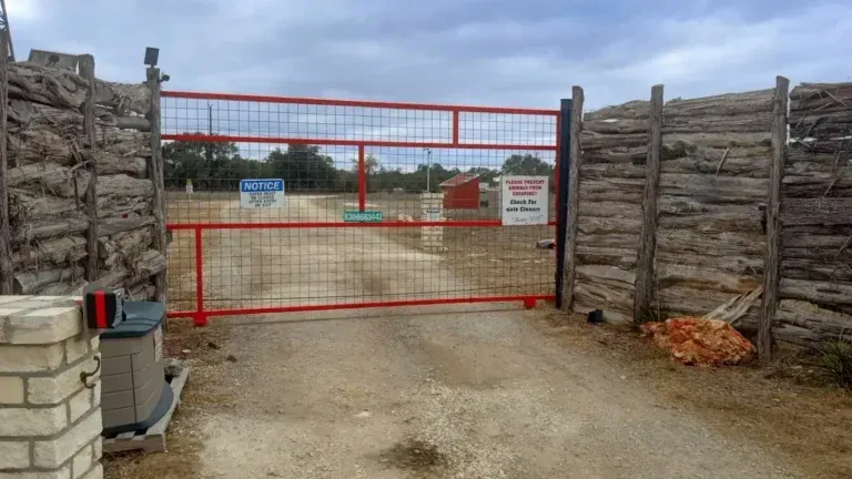
Your wedding day is a special and intimate occasion, and you deserve to celebrate it in a private and secluded setting. Cowboys and Angels Retreat is a fully gated, high-fenced property, ensuring your privacy and security throughout your celebration.
You can relax and enjoy your special day knowing that you and your guests have exclusive access to our beautiful property. This privacy allows you to truly unwind and focus on what matters most: celebrating your love with the people you care about.
Excellent ★ ★ ★ ★ ★ 9.0 | 3 reviews
Cowboys & Angels Retreat: A Quiet RV Park in Texas Hill Country Worth Discovering
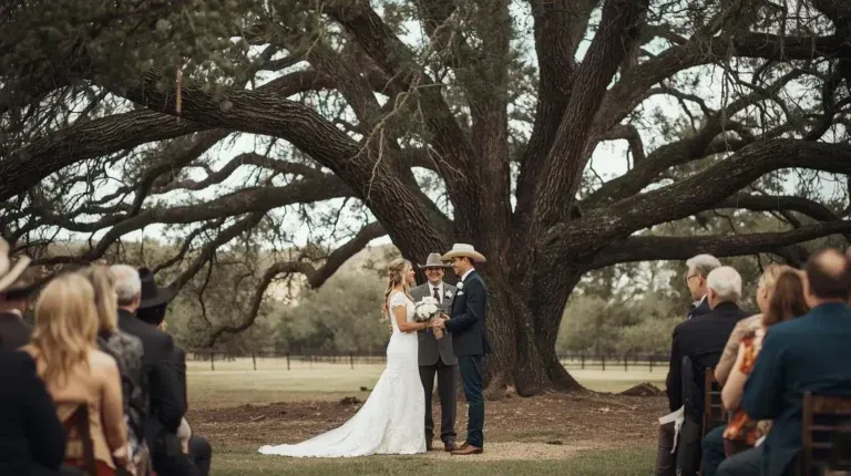
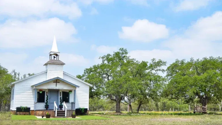
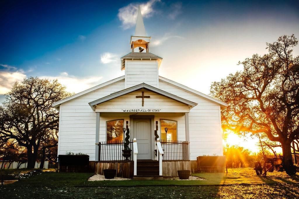
1. Your “Happily Ever After” Starts in Our Charming Chapel
Every love story deserves a beautiful beginning, and our charming chapel provides the perfect setting for your vows. Picture this: sunlight streaming through the windows, illuminating the happy tears and joyful smiles as you say “I do.” The chapel offers a traditional and intimate space for your ceremony, creating a memory you’ll cherish forever.
Whether you envision a classic, formal ceremony or something a little more relaxed and rustic, our chapel can be adapted to suit your style. It’s a blank canvas ready to be transformed into the sacred space where you’ll begin your married life. We can accommodate various seating arrangements, and the natural light makes for stunning photographs.
Ready to Say “Yes” to Cowboys and Angels Retreat?
If you’re looking for a Texas Hill Country wedding venue that combines rustic charm, modern amenities, and unparalleled natural beauty, look no further than Cowboys and Angels Retreat. We’re confident that we can provide the perfect setting for your dream wedding.
Contact us today to schedule a tour and learn more about our wedding packages. We can’t wait to help you create a wedding celebration that you and your guests will cherish forever. Let’s start planning your happily ever after!
Excellent ★ ★ ★ ★ ★ 5.0 | 18 reviews
Excellent ★ ★ ★ ★ ★ 4.6 | 11 reviews
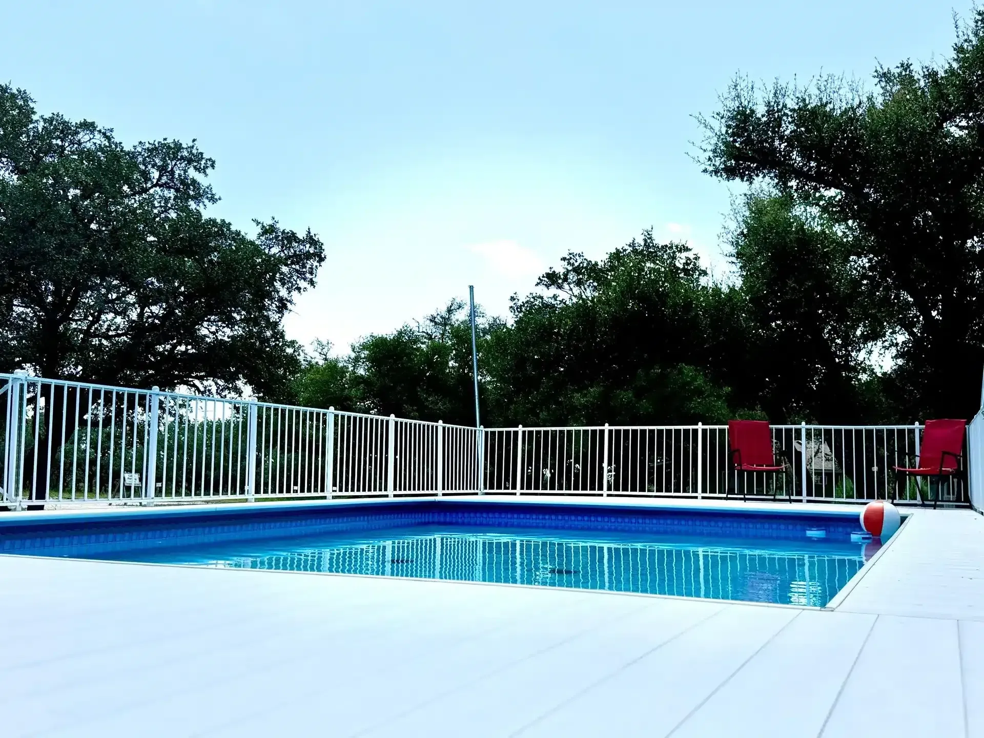
6. Relax and Recharge: Pool and Hot Tub Fun!
Wedding planning can be stressful, so it’s important to take time to relax and recharge. Our outdoor pool and hot tub provide the perfect oasis for you and your guests to unwind and enjoy the beautiful Hill Country scenery.
Take a dip in the pool to cool off on a hot Texas day or soak in the hot tub under the stars. These amenities offer a fun and relaxing way to bond with your wedding party and create lasting memories.
Excellent ★ ★ ★ ★ ★ 4.9 | 17 reviews
If you’re searching for an RV park in Texas Hill Country that offers real peace, dark skies, and abundant wildlife, you’re not alone. Texas Hill Country RV travelers increasingly want more than a crowded campground or a busy highway pull-off – they want a quiet, nature-driven experience that feels like an escape from the world.
That’s exactly what makes certain Hill Country RV parks so extraordinary: the silence, the stars, and the chance to see wildlife right outside your RV door.
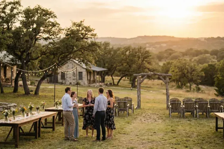
What makes Cowboys and Angels Retreat a unique Texas Hill Country wedding venue?
Cowboys and Angels Retreat offers a private, gated setting in the heart of the Texas Hill Country, combining a charming chapel, rustic reception barn, outdoor pavilion, on-site cabins, RV accommodations, and breathtaking natural scenery. Unlike traditional venues, couples can host a full wedding weekend experience with guests staying right on the property.
Can wedding guests stay overnight at your venue?
Yes! One of the biggest advantages of our Texas Hill Country wedding venue is on-site lodging. We offer nine western-themed cabins as well as RV sites with full hookups. Many couples turn their celebration into a full weekend getaway so guests can relax and enjoy the Hill Country without worrying about transportation.
Do you offer both indoor and outdoor ceremony options?
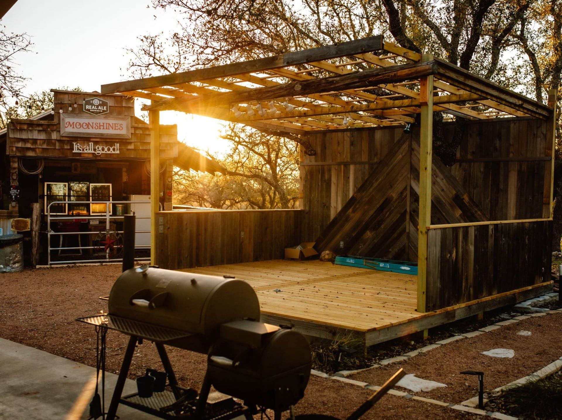
Absolutely. Couples can exchange vows in our charming chapel for a more traditional ceremony or choose one of our outdoor spaces surrounded by rolling hills and natural beauty. Our reception options include an indoor rustic party barn and a covered outdoor pavilion under the Texas sky.
Is your venue private for wedding events?
Yes. Cowboys and Angels Retreat is a fully gated and secluded property, providing privacy and security for you and your guests. When you book your wedding with us, you and your guests enjoy exclusive access to the venue for your celebration.
What time of year is best for a Texas Hill Country wedding?
The Texas Hill Country is beautiful year-round, but spring and fall are especially popular for weddings due to mild temperatures and blooming wildflowers. Summer offers long evenings and incredible stargazing opportunities, while winter provides a quiet, intimate atmosphere.
Do you offer wedding packages?
Yes. We provide customizable wedding packages designed to fit your vision and budget. Whether you’re planning a micro wedding, destination-style celebration, or a full wedding weekend, our team works with you to create an unforgettable experience.
Can we host a wedding weekend with activities for guests?
Definitely. Many couples plan full wedding weekends at our Texas Hill Country wedding venue. Guests can enjoy the pool and hot tub, gather around the large firepit, explore nearby wineries and attractions, and experience unforgettable stargazing under the dark Hill Country skies.
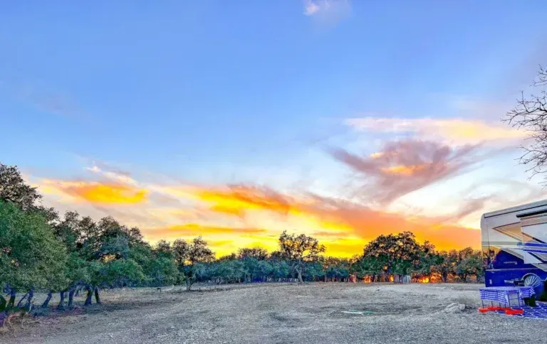
The Hill Country’s Secret: Some of the Darkest Skies in Texas
One of the biggest surprises for first-time visitors is just how brilliant the night sky can be.
Much of the Hill Country sits far from large cities, meaning light pollution is incredibly low. In Mountain Home and surrounding rural areas, it’s even better – skies reach Bortle Class 3, which is extremely rare in Texas.
This means RV travelers can enjoy:
- Milky Way visibility
- Shooting stars and meteor showers
- Constellations you can’t see near cities
- Crystal-clear night sky photography
A quiet RV park in the Hill Country isn’t just a place to sleep – it becomes your own personal observatory.
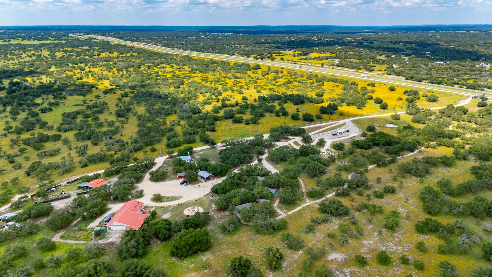
Located in Mountain Home, just west of Kerrville, Cowboys & Angels Retreat is one of the few RV parks that truly embodies everything travelers love about the Hill Country:
FAQ
Searching for the right Texas Hill Country wedding venue comes with a lot of questions—cost, guest capacity, ceremony and reception setup, rain backup plans, lodging for guests, and how private the venue really is. At Cowboys & Angels Retreat, we make planning easy by offering a secluded Hill Country venue with spaces for weddings and celebrations plus accommodations on-site for your guests. Here are the most frequently asked questions from couples considering our venue for their Texas Hill Country wedding.
Excellent ★ ★ ★ ★ ★ 5.0 | 218 reviews
Why Choose a Quiet RV Park in Texas Hill Country?
The Texas Hill Country is famous for its rolling hills, scenic drives, small towns, and wide-open skies — but not all RV parks offer the same experience. Many travelers today are intentionally looking for places that feel quieter, more spacious, and more connected to nature. That often means choosing thoughtfully designed sites, like back-in RV sites, that allow for more separation, less traffic flow, and a more peaceful stay overall.
For many guests, the appeal of a Hill Country RV park comes down to a few simple but important qualities:
For many guests, the ideal Hill Country RV park includes quiet nights without highway noise, big sky views with minimal light pollution, daily wildlife sightings, and plenty of space between RV sites. A truly quiet RV park in Texas Hill Country gives you room to breathe — and room to enjoy the slower pace and natural beauty that make this region special.
- Quiet, peaceful nights without highway noise
- Big sky views with almost no light pollution
- Daily wildlife sightings
- Space between RV sites
- A slower, more relaxed atmosphere
A truly quiet RV park in the Hill Country gives you room to breathe — and room to enjoy the nature that makes this region special.
Excellent ★ ★ ★ ★ ★ 9.6 | 140 reviews
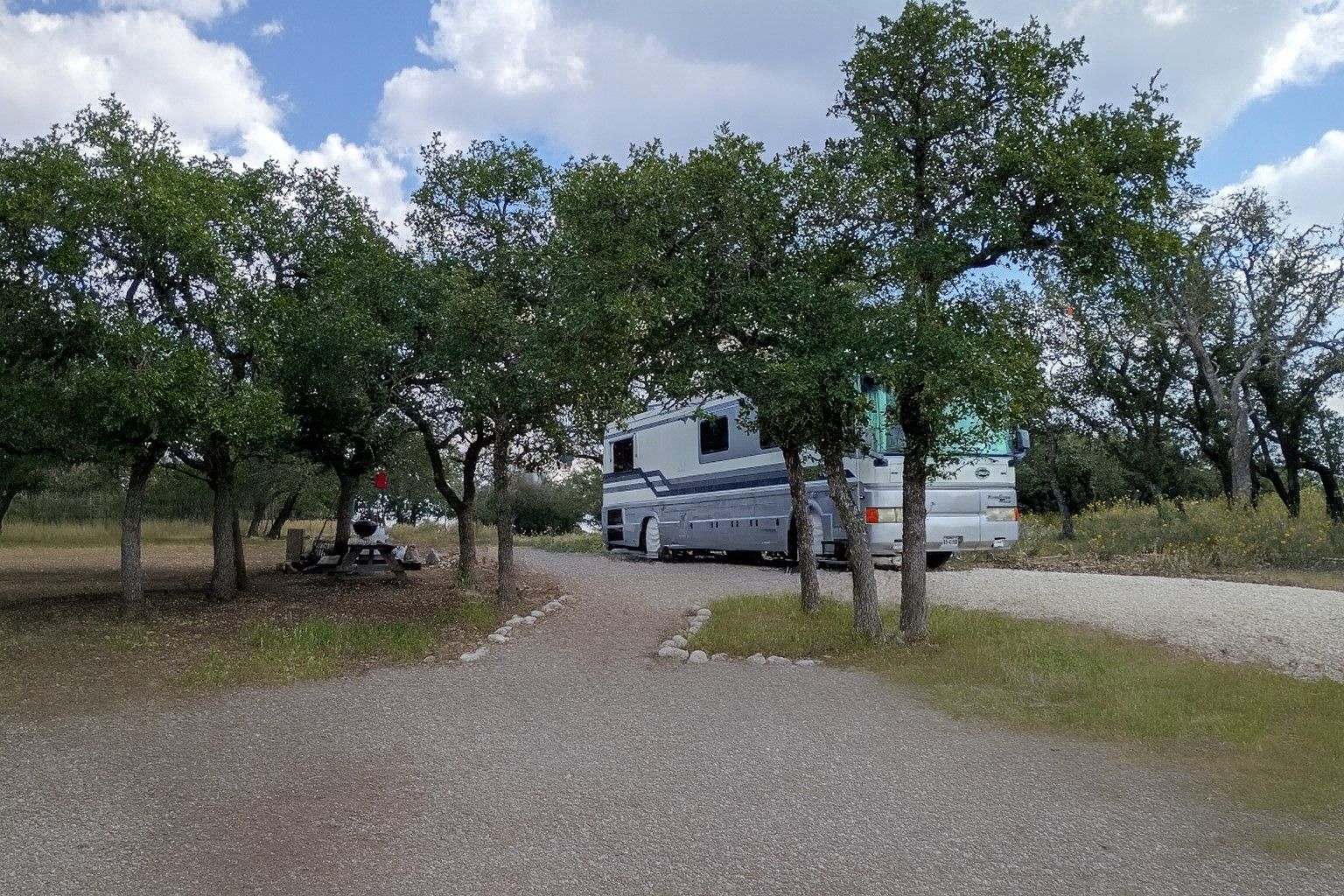
3. Accommodate Your Whole Crew: Cabins and Campsites Galore
One of the biggest challenges of wedding planning is finding accommodations for your wedding party and out-of-town guests. At Cowboys and Angels Retreat, we’ve got you covered! We can comfortably accommodate your entire wedding party and many of your guests right here on the property.
Many couples planning smaller, more personal celebrations are drawn to venues that feel relaxed, private, and connected to nature. If you’re envisioning a quieter guest list and a more meaningful experience, you may also enjoy reading about our Small & Intimate Wedding Venues in the Texas Hill Country, where we explore why intimate celebrations pair so beautifully with peaceful Hill Country settings.
If staying onsite is a must-have for your wedding weekend, you might also like our guide on wedding venues with onsite lodging in Texas Hill Country—it walks through what to look for and why couples love keeping everyone together from the last dance to the next-morning coffee.
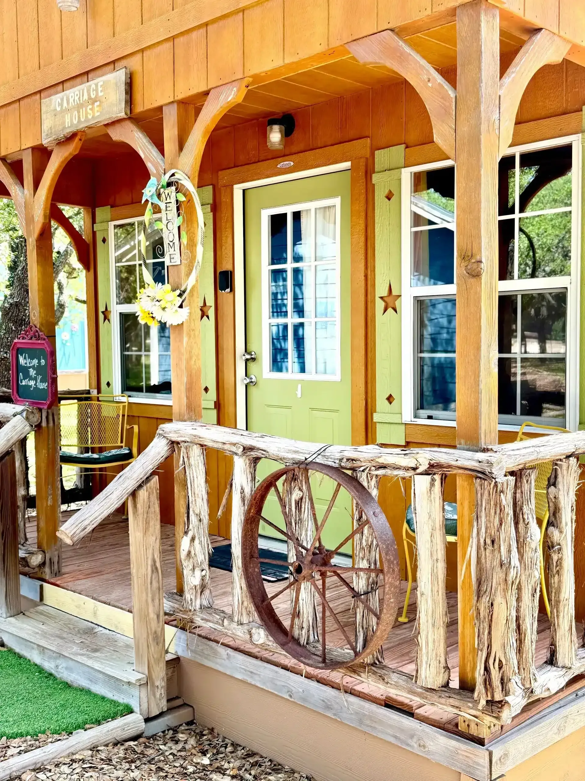
- Nine Western-Themed Cabins: Cozy Comfort: Our charming cabins provide a comfortable and relaxing retreat for your guests. They’re perfect for families or couples who want to enjoy the beauty of the Texas Hill Country in a private setting. Each cabin is uniquely decorated and equipped with all the amenities you need for a relaxing stay. Imagine waking up to the sounds of nature and enjoying a cup of coffee on your private porch as you watch the deer.
- Accommodate Your Whole Crew: Cabins and Campsites Galore: Many couples and their guests love turning it into a full wedding weekend with our secluded Texas Hill Country cabin rentals.
- Romantic Cabins for the Wedding Couple: A Dreamy Hill Country Honeymoon Stay: After the celebration, slip away for a quiet, unforgettable getaway in one of our romantic cabins—perfect for newlyweds. Enjoy peaceful mornings on the porch, friendly deer visits, and star-filled nights in a prime stargazing area. Read more about our romantic cabins here.
- Plenty of RV Campsites: Embrace the Outdoors: For guests who prefer a more rustic experience, we offer well-maintained RV camping in the Texas Hill Country with all the necessary hookups.
Having your wedding party and guests stay on-site creates a truly immersive and memorable experience. It allows everyone to relax, connect, and enjoy the celebration without worrying about transportation.
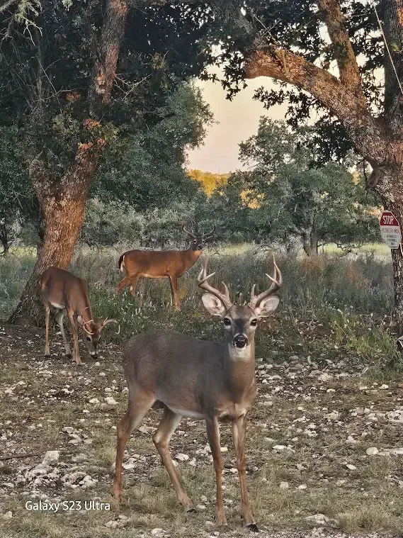
Wildlife Watching: A Hill Country Highlight
Another thing that sets certain Hill Country RV parks apart is the wildlife. Travelers often describe wildlife encounters as the most memorable part of their trip.
Common sightings include:
- Axis deer
- Whitetail deer
- Blackbuck
- Wild turkey
- Jackrabbits
- Foxes
- Dozens of native and migratory birds
Some parks offer occasional wildlife sightings, but Cowboys & Angels Retreat takes the experience to another level. Here, guests can enjoy wildlife viewing right from their RV site – deer grazing at sunrise, birds gliding through the trees at dusk, and quiet mornings filled with natural movement.
What truly sets us apart is that Cowboys & Angels is a gated, high-fenced property where the deer live safely within the grounds. They freely roam among the campsites and are comfortable around visitors, meaning you’re guaranteed plenty of close-up deer encounters throughout your stay.
For many RVers, this is the exact experience they hoped to find in the Hill Country – peaceful, natural, and unforgettable.
✔ Quiet, Peaceful Atmosphere
Cowboys & Angels Retreat offers the rare combination RV travelers love: true peace and quiet without being miles down a rough country road.
The park sits just off I-10 for easy access, yet it is tucked far enough into the woods that you hear zero highway noise.
No crowded resort traffic. No road noise. No constant movement.
Just open hill country space, birdsong, gentle breezes through the trees, and the rustling of wildlife.
It’s the kind of quiet that’s hard to find – and even harder to leave.
Excellent ★ ★ ★ ★ ★ 4.9 | 598 reviews
5. Wildlife Encounters: Nature’s Wedding Guests
One of the unique charms of Cowboys and Angels Retreat is the abundance of wildlife that freely roams the property. Don’t be surprised if you spot deer grazing nearby or chickens pecking around the grounds. These natural inhabitants add a touch of whimsy and wonder to your wedding celebration.
Imagine capturing stunning wedding photos with deer grazing in the background or enjoying a cocktail hour serenaded by the sounds of nature. These unexpected encounters will create memories that you and your guests will cherish for years to come.
Your Dream Wedding, Your Way: Customizable Packages
At Cowboys and Angels Retreat, we’re dedicated to making your Texas Hill Country wedding venue dreams a reality.
We understand that every couple has a unique vision for their wedding day. That’s why we offer a variety of wedding packages to suit your needs and budget. Whether you’re looking for an all-inclusive package or prefer to create your own custom celebration, we’re here to help you bring your dreams to life.
Our experienced team will work closely with you to plan every detail of your wedding, from the ceremony to the reception to the accommodations. We’ll take care of the logistics so you can relax and enjoy your special day.